Coastal Environmental
Analysis and Permitting
A key component of resilient coastal engineering design is understanding the potential environmental impacts of proposed projects. Specifically, development of an in-depth engineering alternatives analysis is a key component for ensuring successful project outcomes. The Coastal Solutions staff is well-versed in all technical aspects of developing the most resilient shore protection design strategies, as well as understanding the environmental regulatory framework that often limits engineering activities in the coastal zone. Coastal Solutions prides itself in our ability to work collaboratively with environmental regulatory agencies to solve complex coastal engineering problems.
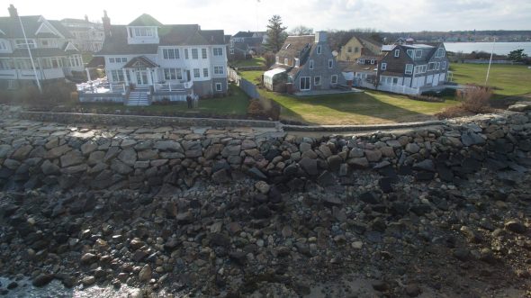
Decision makers use environmental impact assessments to determine the potential effect of proposed actions on the environment. Coastal Solutions provides expert analysis of waves, currents, sediment transport, and future sea-level rise to assess the range of potential engineering solutions. Detailed assessment of existing conditions and an evaluation of the potential impacts caused by proposed actions is the foundation for all local, state, and federal permitting documents typically required for engineering activities in the coastal zone. The staff at Coastal Solutions routinely prepares necessary environmental regulatory documentation for coastal engineering projects.
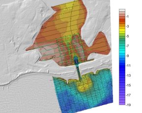
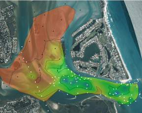
Throughout our history of coastal engineering work, the senior staff at Coastal Solutions have been at the forefront of innovative and ‘nature-based’ techniques for shore protection design. These approaches often require unique environmental permitting approaches, as the regulations governing coastal work were generally not written to account for changes in shore protection strategies. Working with environmental regulatory agencies, our group has permitted projects including inlet relocation and widening, new T-head and traditional groin structures, as well as mixed-sediment beach nourishment and other nature-based strategies.
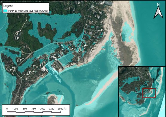
Coastal Environmental Analysis and Permitting Capabilities
- Assessment of engineering alternatives
- Evaluation of environmental impacts
- In-depth understanding of regulatory framework
- Local, state, and federal permitting
- Coastal structure impact assessment
- Numerical model simulations
- NEPA documentation
- Innovative permitting strategies
Example Projects
Review of Updates to FDEP BMAP and Lake Okeechobee System Operating Manual (2020-2022)
Coastal Solutions’ team assisted Martin County in the review of the 2020 updated Basin Management Action Plan (BMAP) for the Saint Lucie River and Estuary Watershed (SLREW) and the 2021 update to the Lake Okeechobee system Operating Manual (LOSOM). The analysis support is provided so that the County can advocate for improvements to estuary water quality and habitat.
The SLR Estuary BMAP update incorporates progress and sets nutrient reduction targets for the St. Lucie watershed as part of the St Lucie nitrogen and phosphorus Total Daily Maximum Load (TMDL) targets set by FDEP to restore estuarine water quality in the estuary. The engineers of Coastal Solutions assessed model assumptions and output provided by FDEP and SFWMD in order to evaluate the accuracy and adequacy of the analysis that forms the basis of the BMAP. The assessment of the BMAP analysis required the review of model input data, calibration statistics and results from the Watershed Water Quality Simulation (WaSH) model of the St Lucie watershed, which is used to simulate the transport of water quality constituents through the watershed basin. The assessment also required a review of the CH3D model developed by the SFWMD to simulate tidal dynamics and salinity dispersion in the St Lucie/Indian River estuary system.
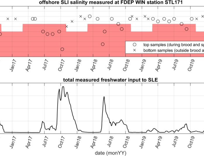
The County’s participation in the development of the LOSOM process is critical to ensuring that discharges to St Lucie Estuary from the Lake are kept to a minimum. Analyses of existing hydrologic, water quality and salinity data showed definitively the tendency for discharges from the Lake to extend the duration of harmfully low salinities for sensitive corals along the coastline.
Egypt/Mann Hill Beach Cobble Berm Reconstruction Scituate, MA
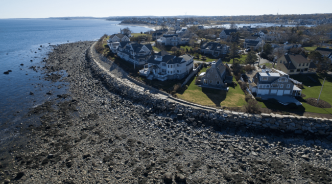
Coastal Solutions team members designed and permitted the reconstruction of the cobble berm on Egypt and Mann Hill Beaches to as-built conditions. This is a berm with a 10-ft wide crest at an elevation of 20 feet NAVD88 with a 3H:1V side slope on the oceanside and a 2H:1V side slope on the landward (pond) side.
The Town of Scituate experienced significant coastal damage in the vicinity of Egypt and Mann Hill Beaches during Winter Storm Nemo (February 8-9, 2013). The severity of this winter storm caused the state declaration of a major disaster; DR-4110 (NEMO). According to estimates by the Town of Scituate DPW, approximately 15,000 cubic yards of material was eroded from the cobble dune system as a result of the storm. Based on this documented loss in cobble berm volume, the Town applied for and received FEMA grant funding through the Public Assistance Grant Program to proceed with design and construction improvements to pre-disaster conditions. The berm experienced additional damage during Winter Storm Riley (March 1-3, 2018) and an existing conditions survey from December 2018 calculated that it will require approximately 17,898 cubic yards to return the full length of the berm to pre-disaster conditions.
Coastal Solutions team members designed and permitted the full length and volume of berm reconstruction and assisted the Town in phasing the project to optimize available funding while maintaining the integrity of the design to provide adequate shore protection.
Coastal Erosion, Sediment Transport, and Prioritization Management Strategy Assessment for Shoreline Protection, Scituate, MA
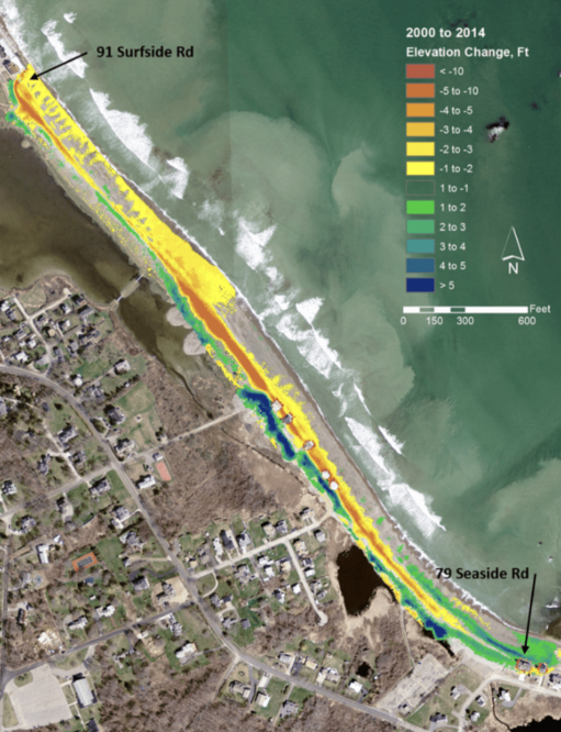
Coastal Solutions team members assisted the Town of Scituate to pursue a long-term planning effort to identify ongoing coastal erosion and the sediment transport pathways that govern this process, screen potential shore protection strategies to determine their applicability, assess both historical storm damage and needed shore improvement costs by shoreline reach, and prioritize shore protection and/or other management strategies based on potential costs and storm protection benefits. This town-wide optimization/prioritization shore protection planning effort received funding from the Executive Office of Energy & Environmental Affairs (EOEEA) Coastal Community Resilience Grant Program for Fiscal Year 2016.
The Town of Scituate suffers extensive flood damage along many of its east-facing beaches, with total FEMA repetitive loss claims in excess of $61.8 million from 1978 to March 2015. Ongoing threats to public and private infrastructure continue to be a major concern for the Town, as both long-term coastal erosion and relative sea-level rise in the coming decades will continue to exacerbate regional storm damage. A report was developed to provide a “roadmap” that the Town can utilize to proactively plan for projects that will improve the coastal resiliency of the community. Specifically, the report analyzed coastal change and sediment transport processes, assessed historical storm damage based on storm severity, developed prioritization criteria for coastal resiliency, determined appropriate shore protection and/or coastal management approaches, and evaluated shore protection and/or management strategies by shoreline stretch. Findings were presented at two public working sessions.
