Wave and Sediment
Transport Modeling
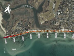
Coastal Solutions personnel perform detailed coastal processes analyses and numerical simulations of spectral wave transformation and nearshore sediment transport to support engineering design evaluations and project feasibility studies. Input spectral wave conditions from offshore measurements or wave hindcast simulations provide boundary parameters for propagating wave energy landward over variable bathymetry using spectral wave models such as STWAVE, CMS, Mike21, and SWAN, as well as the Delft3D suite. Output model results provide input for nearshore processes models that are utilized to compute sediment transport rates and geomorphic change. Sediment transport modeling tools include Delft3D, XBeach, CMS, and Exodus (an in-house one-line shoreline change model). Understanding that numerical model results are only as valid as the data utilized to parameterize the input and calibrate/validate the output, Coastal Solutions prides itself on a data-driven modeling approach that ensures results reflect real-world conditions.
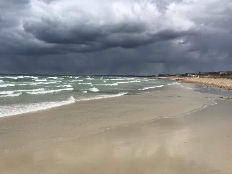
Once existing wave and sediment transport processes in a project area are understood, the impact of proposed engineering activities (e.g., dredging at an offshore borrow site; placement of beach fill, or the influence of coastal structures on adjacent shorelines) are determined within the context of natural variability within the system. Coastal Solution personnel have conducted numerous wave and sediment transport modeling projects along the east and Gulf coasts, including environmental impact evaluations of sand mining, inlet sediment budgets, assessment of wave forces for coastal structure design, and impact analyses of coastal engineering structures. In addition, wave modeling procedures are employed regularly to evaluate engineering designs related to beach nourishment and other shoreline management projects. Most importantly, model results are always verified within the context of coastal process measurements and historical data sets to gage the reliability of model output.
Understanding that coastal numerical modeling results can seem overwhelming to someone not trained in a related field, Coastal Solutions has always prided itself on providing results in a manner that is comprehensible to a non-technical audience. Our staff is well-versed in developing appropriate graphics and visualizations of complex concepts in a manner that is useful for public consumption.
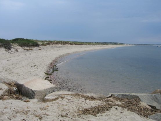
Wave and Sediment Transport Modeling Capabilities
- Spectral wave analyses
- Wave transformation simulations
- Wave/current interaction
- Longshore sediment transport rates
- Morphological change modeling
- Cross-shore transport assessments
- Sediment infilling rates
- Cohesive sediment transport
- Shoreline change predictions
- Sediment transport analyses
- Assessment of long wave processes
Example Projects
Effects of Cotuit Entrance Channel Maintenance on Coastal Processes and Coastal Flooding Potential
To manage the Dead Neck barrier beach system in Barnstable, MA a plan was developed to dredge a portion of the accreted western ‘spit’ of the island and back-pass this material to its eastern end. Dredging of the spit had last occurred in 1968, and since that time, the entrance to Cotuit bay has narrowed to about a quarter of its width prior to 1940. As the spit has grown into the entrance channel, erosion of the mainland shoreline of the inlet has become an issue. The town has also become concerned about navigation safety through the narrowing inlet.
With a more proactive maintenance dredging program, it is anticipated that the future inlet can be maintained in a similar configuration to the inlet that existed prior to the 1960s, where the Cotuit Bay entrance provided a wider, more hydraulically efficient pathway for tidal waters entering the Three Bays estuary. In addition, material dredged from the accreting spit will be utilized to maintain the integrity and resiliency of the barrier beach system.
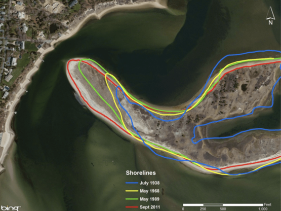
In order to provide a quantitative assessment of the potential impacts associated with the proposed dredging activities, broad assessment of coastal process was undertaken which included 1) a historical analysis of shoreline change for the time periods that represent the wider inlet system (1968 to 2001) and the more recent narrow inlet configuration (2001 to 2011), 2) a 2D numerical modeling assessment of alterations to tidal hydrodynamics associated with potential inlet modifications, as well as the influence of these tidal current changes on coastal erosion potential, 3) an evaluation of the influence of the existing barrier beach spit at the western terminus of Sampson’s Island on preventing flood protection and/or storm damage prevention for properties westward of the barrier beach system, and 4) a determination of existing bathymetric conditions offshore of the Cotuit Bay entrance and the assessment of likely changes to typical wave conditions along the Bluff Point shoreline that may be created by removal of a portion of the barrier spit.
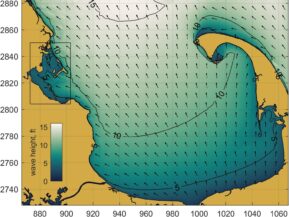
Several important findings resulted from the analysis would be used to direct the future maintenance of the inlet channel and the Dead Neck barrier island resource. The historical analysis of shoreline change analysis indicated that the shoreline erosion rate has increased since 2001. The numerical modeling assessment of tidal hydrodynamics indicated that widening of the tidal inlet will reduce tidal currents and the potential for erosion along the Cotuit shoreline in the vicinity of the inlet. Although the low elevation barrier spit provides minimal protection from storms, the position of the Cotuit Bay entrance provides natural protection from significant storm wave attack. An area of shallow shoals causes a reduction in wave heights offshore of this region and this area will not be affected by the proposed dredging. This shoal field will continue to provide the Cotuit Bay entrance with protection from larger waves after the spit is dredged.
Numerical Modeling to Update Sediment Budget for St. Lucie Inlet (2019-2022)
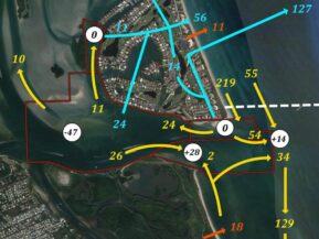
A detailed coastal processes modeling analysis including hydrodynamic, wave, and sediment transport was focused on developing an in-depth understanding of sediment transport pathways within the vicinity of St. Lucie Inlet. These numerical analyses built on previous modeling tools and provided refinements to the inlet sediment budget that had been adopted in 2016. Specifically, state-of-the-science numerical modeling tools were utilized to quantitatively evaluate sediment sources and sinks, as well as the migration of sediment throughout the inlet region. These same models also can serve as the basis for other project-specific analyses related to physical processes in the vicinity of the inlet.
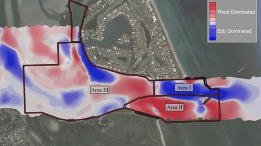
Four unique models were utilized for the project:
- EXODUS shoreline model: The one-line shoreline model EXODUS was utilized at the northern end of Jupiter Island, to evaluate shoreline response and alongshore sediment transport rates, as much of the incoming wave energy is attenuated by offshore reefs and relatively low tidal currents,
- Delft3D flow model: The focus of the standalone flow modeling approach was for the refinement of sediment transport pathways within the estuarine area not influenced by waves.
- Delft3D Integrated Flow and Wave model: The integrated model was utilized to simulate relative sediment transport pathways and quantities associated with combined wave and tidal current induced transport over the nearshore region, inclusive of the inlet throat and offshore areas both north and south of the inlet.
- XBeach 2D model: XBeach was used to resolve the nearshore hydrodynamic processes associated with the complex nearshore morphology north of St. Lucie Inlet, including the reef system fronting Bathtub Beach and Sailfish Point Beach. Specifically, the model was able to reproduce the wave-induced current regime generated by wave set-up during energetic wave conditions both inside and outside the reef. This produced realistic simulations of the observed erosion and north-to-south sediment transport within the nearshore area.
The use of the modeling tools, combined with the extensive coastal processes and bathymetry data sets, provided the basis for the sediment transport pathways evaluation and associated sediment budget calculations to facilitate ongoing management of the inlet.
